Madagascar  |  News  |  For Kids  |  Wildlife  |  Photos: Wildlife | Scenery | People | Topics index

Photos of aerial scenery in Madagascar [updated 2013-02-13]


Calendars


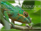
Chameleons of Madagascar - 12-month calendar


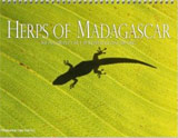
Herps of Madagascar - 12-month calendar


Lemurs of Madagascar - 12-month calendar


Madagascar - 18-month calendar


Madagascar Calendar - 12-month calendar


Madagascar Calendar II - 12 months by mongabay


Wildlife of Madagascar - 12-month calendar


Budget Calendars


Housing for miners in southern Madagascar


Aerial view of dry forest (Fort Dauphin - Tana Flight)


Aerial view of Nosy Mangabe and the Bay of Antongil


Aerial view of deforestation in western Madagascar (Tulear)


Aerial view of rice paddies outside of Fort Dauphin


Rice field near Tana (aerial view)


Aerial view of Berenty sisal plantation area (Berenty)


Deforestation in Makira


Aerial lavaka near Maroantsetra in Madagasar


Aerial view of deforestation in Madagasar


Deforestation near Ft. Dauphin


Aerial view of the Mandrare River, gallery forest of Berenty, and sisal


Sunset over highlands of Madagascar (Fort Dauphin - Tana Flight)


Aerial view of deforestation and erosion in southern Madagascar (Isalo)


Aerial view of deforestation and erosion in southern Madagascar (Isalo)


Aerial view of rice paddies outside of Fort Dauphin


Aerial view of an Antandroy village


Agricultural patchwork/landscape outside Fort Dauphin


Aerial view of deforestation and erosion in southern Madagascar (Isalo)


Aerial view of deforestation in western Madagascar (Tulear)


Aerial view of deforestation in Madagasar


Aerial view of the road to Berenty, cleared hillsides in southern Madagascar


Breaking waves in southern Madagascar (Ft. Dauphin)


Aerial view of deforestation in Madagasar


Aerial view of dry forest (Fort Dauphin - Tana Flight)


Deforestation near Ft. Dauphin


Coastline near Tolagnaro in southern Madagascar (Ft. Dauphin)


Sunset over highlands of Madagascar (Fort Dauphin - Tana Flight)


Deforestation near Ifaty (Tulear)


Airplane view of deforestation in Madagasar


Aerial view of mountains, spiny forest, and a village outside Fourt Dauphin


Aerial view of deforestation in Madagasar


Aerial view of Lake Alaotra


Aerial view of rice paddies, forest degradation, and erosion in southern Madagascar


Deforestation near Ft. Dauphin


Rice cultivation near Lake Alaotra


Aerial view of deforestation in western Madagascar (Tulear)


Mining near Ft. Dauphin


Aerial view of deforestation and erosion in southern Madagascar (Isalo)


Aerial view of deforestation in Madagasar


Mining near Ft. Dauphin


Riverbed near Tulear (Tulear)


Aerial view of cultivated lands near Maroantsetra


Aerial of fire (Ankavandra)


Deforestation in Northern Madagascar


Aerial view of Nosy Mangabe, the Bay of Antongil, and cultivated lands near Maroantsetra


Aerial view of an Antandroy village


River siltation in Madagascar (Tulear)


Aerial view of Lake Alaotra


Rice field near Tana (aerial view)


Aerial view of Nosy Mangabe and the Bay of Antongil


Page 1 | Page 2 | Page 3 | Page 4 | Page 5 | Page 6 | Page 7

Please note: photo captioning is still in progress. If you know the ID of any unidentified species, please let me know.

FEEDBACK: Correct errors on this page or comment on this photo. High resolution photos available here.

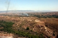
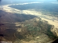
This is the photo section of the site. For more information on Madagascar please browse the following sections of WildMadagascar.org: All images are the property of Rhett Butler, copyright 1997-2009.

Contact me regarding use and reproduction.


home | photos index | search photos | about the site | contact


All images are the property of Rhett Butler, content copyright 2004-2013.
All rights reserved.