Aerial view of deforestation for agriculture in Madagascar
|
|
|
|
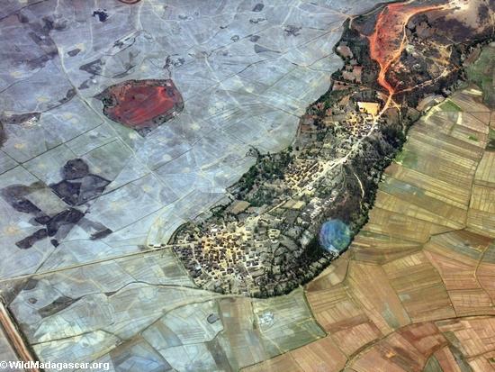
Aerial view of deforestation for agriculture in Madagascar
Airplane flight from Anatananarivo to Maroantsetra | Scenery | Aerial | Deforestation
FEEDBACK: Correct errors on this page, comment on this photo, or submit your own Madagascar pictures.
This image may be available on t-shirts, posters, and other media. If you are interested in having the above picture printed on a t-shirt or in another form, please contact me. On the left there is a sample shirt that is available for sale. The shirt has pictures of wildlife from Madagascar, labeled in both English and Malagasy.
Title:
Aerial view of deforestation for agriculture in Madagascar
This is the photo section of the site. For more information on Madagascar please browse the following sections of WildMadagascar.org:
All images are the property of Rhett Butler, copyright 2004.
Contact me regarding use and reproduction.
|
|
|